


Victorian Online Gold Maps: A Comprehensive Tool for Gold Prospectors
NOW WITH LiDAR AREAS
Victorian Online Gold Maps is an intuitive and user-friendly mapping package designed specifically for gold prospectors in Victoria, Australia. This digital tool aims to facilitate the discovery of gold-bearing grounds across the region, providing valuable geographic and geological information to enhance prospecting efforts. Its versatility allows usage across multiple devices, including PCs, tablets, and mobile phones, making it accessible whether at home or out in the field.
Features and Functionalities
- Multiple Viewing Options: Users can switch between map view and satellite view powered by Google Maps, offering detailed visualizations of the terrain and landscape features.
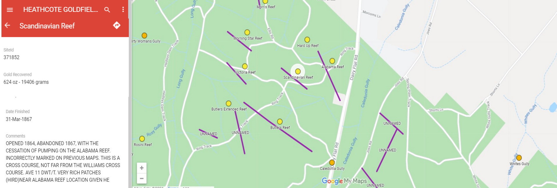
- Navigation and Directions: The system provides directions to specific sites such as gold mines, quartz reefs, or shallow workings, aiding prospectors in planning their routes efficiently.
- Field Use: When in the field, users can utilize their mobile phones to identify nearby gold mines, shallow workings, quartz reefs, and other features, increasing the likelihood of discovering gold deposits.
Data and Information Provided
The Gold Maps of Victoria contain extensive data, surpassing traditional paper maps in detail and usability. The information is organized to facilitate quick access and easy navigation:
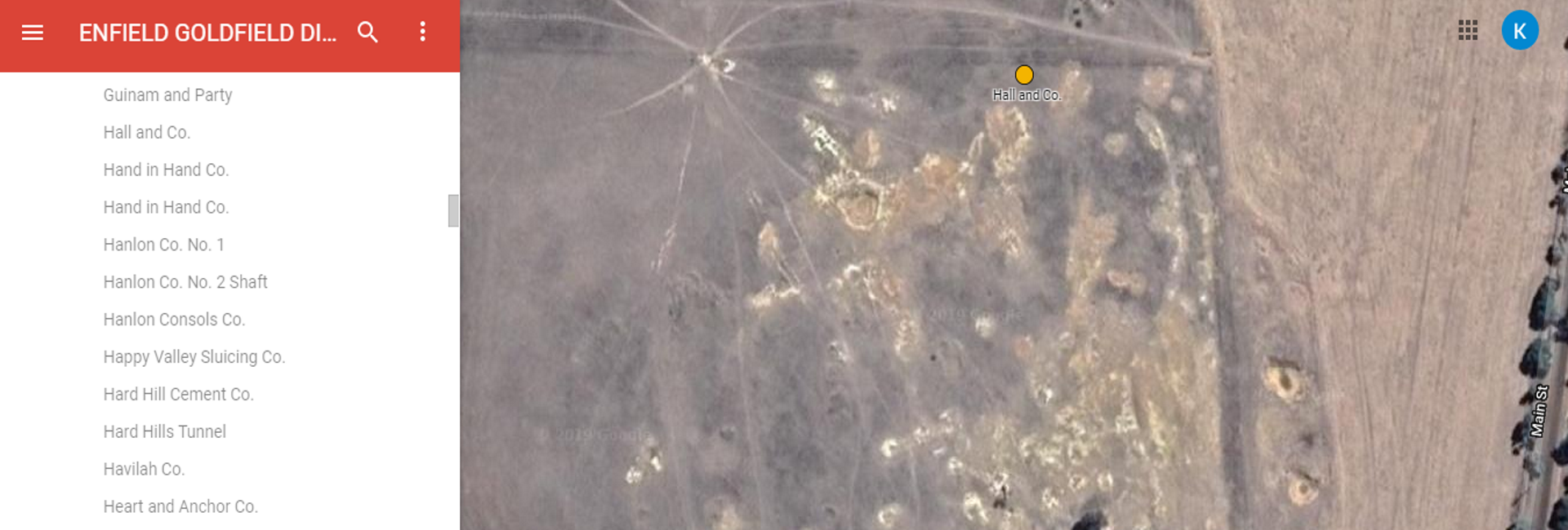
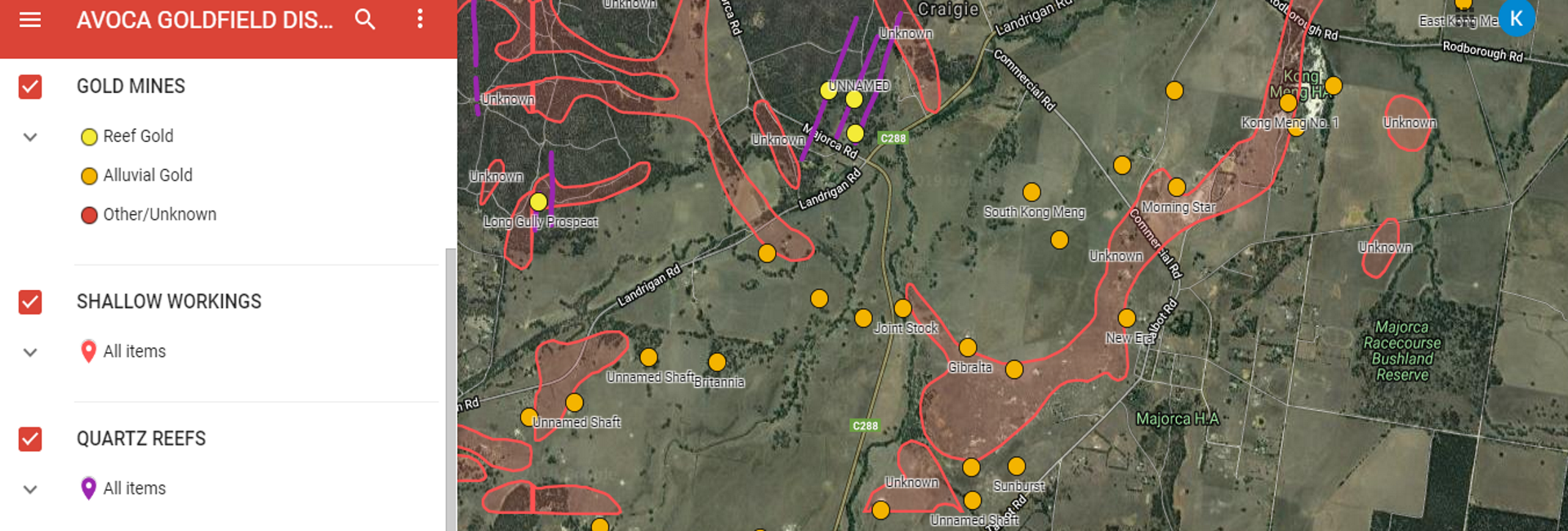
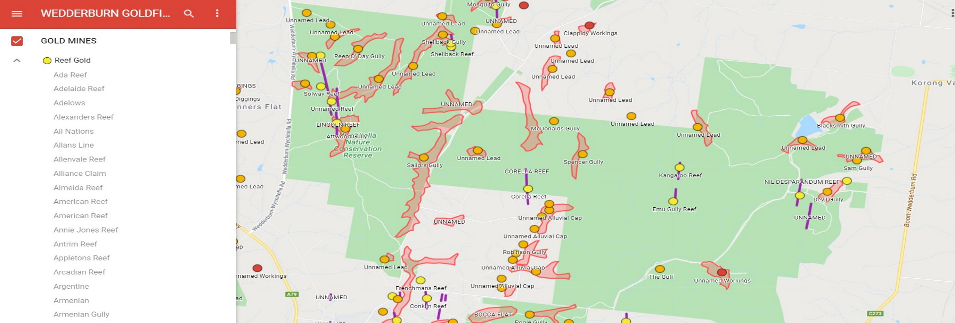
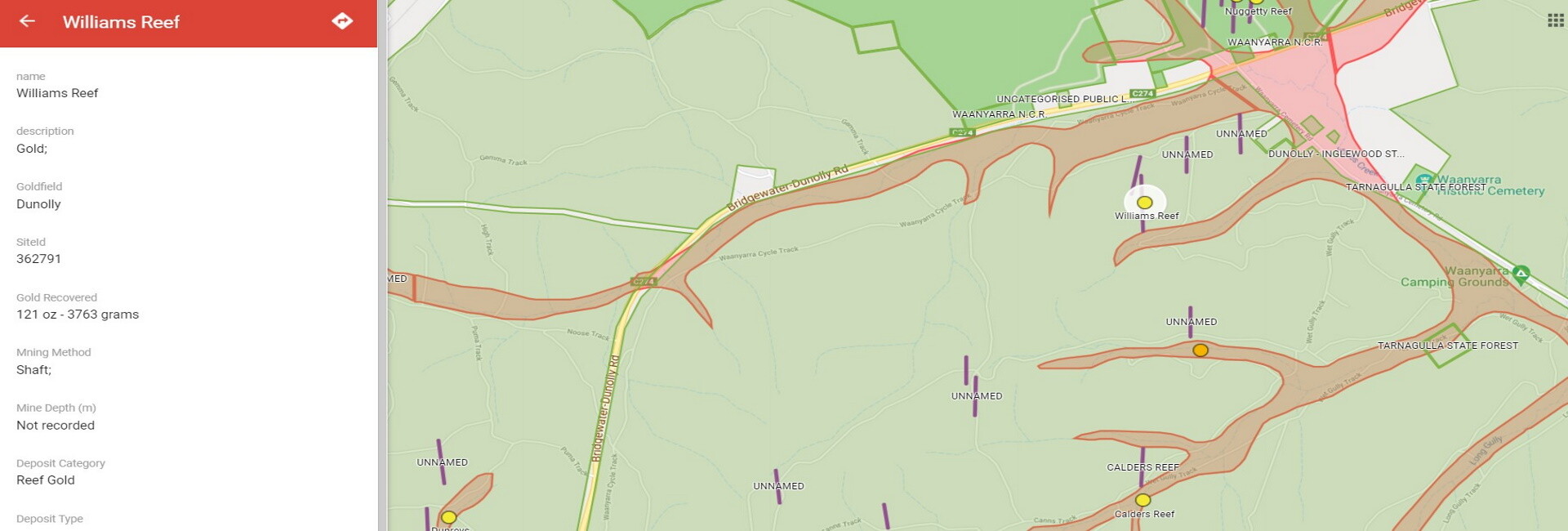
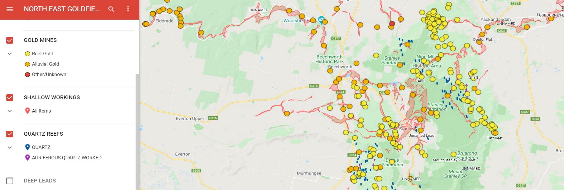
- Gold Mine Locations: Color-coded to distinguish between reef gold and alluvial gold deposits.
- Shallow Workings: Include additional workings shown on historic geological maps.
- LiDAR areas: shallow workings identified using airial laser surveys.
- Quartz Reefs: Both worked and unworked reefs are marked, providing insights into historical and potential future prospecting sites.
- Deep Leads: That in some instances appear at the surface in the upper catchments.
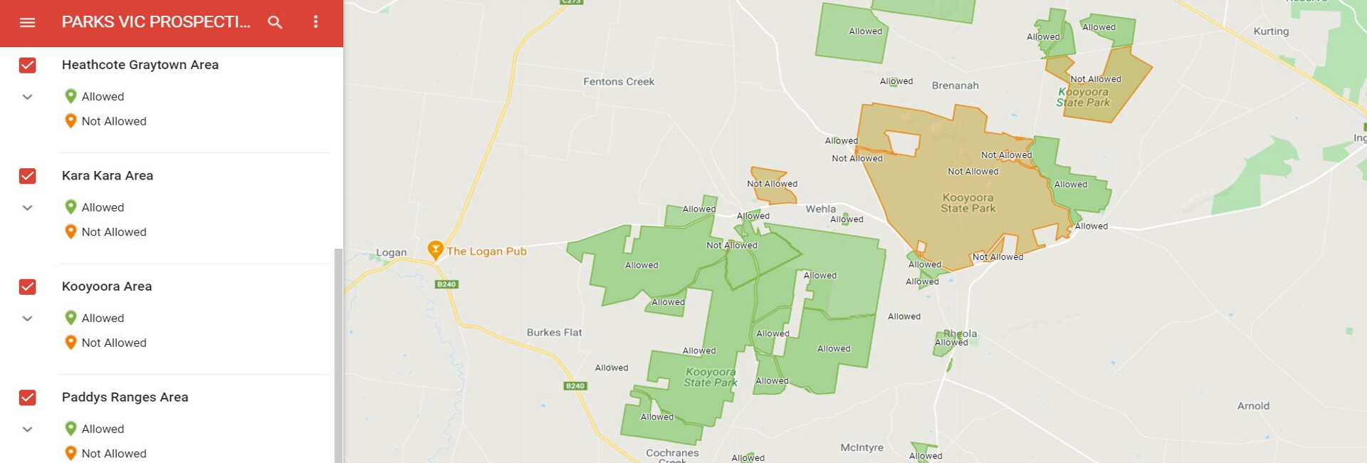
- Crown Land and Parks Victoria areas: Provides insights in the were you can and can’t prospect on public land.
- Alphabetical Listing: All sites are listed alphabetically for quick searching and reference.
Map Series and Coverage
The series comprises 17 maps, including:
- Goldfield District Maps: Covering 172 named Victorian goldfields across 12 maps, providing detailed regional insights.
- Geological Maps: A map linking to 216 historic geological maps, offering geological context for prospecting.
- Special Interest Maps: Four maps available free to subscribers, illustrating Heritage Sites, Planned Burns, Streams with prospecting restrictions, and areas managed by Parks Victoria where prospecting is prohibited or permitted.
Subscription and Access
The Victorian Gold Maps are accessible through an annual subscription model. For detailed subscription information, visit the Buy Gold Maps page.
Overall, Victorian Online Gold Maps serve as a powerful digital resource, combining ease of use with extensive data to support gold prospectors in their search for gold across Victoria, Australia. Its integration of modern mapping technology and detailed geological information makes it an invaluable tool for both amateur and professional prospectors alike.
Click on this map to open the Ballarat Goldfield District and test out the mapping package.

About Us
Victorian Online Gold Maps is an easy to use mapping package to help
gold prospectors discover gold bearing ground.
It can be used on a PC, tablet or mobile phone.

